Leaf Peeping in the White Mountains

Fall in New Hampshire is magical. While it’s a sign that winter is coming (BOO), the grace and beauty of this season makes me almost grateful for winter.  Fall days are wonderful. Indian Summer often springs days in the high 70’s, while the evenings are crisp.

When I first visited New England, Tom took me on a trip up to the Kancamagus Highway to see the fall foliage. Ever since then, this drive, spanning from Lincoln, NH to Conway, NH, has been my very favorite byway in New Hampshire. The road, NH Route 112, is a 56.39-mile-long east–west state highway in northern New Hampshire. This scenic byway skirts the Southern end of the White Mountain National Forest and reaches a peak elevation of around 2900 feet.

The day started out a bit grey, but it didn’t matter. The colors (while not quite at peak) were vibrant and lovely and the day was mild.

Kancamagus Highway Lincoln NH

The beginning of the Kancamagus Highway

There were a surprising number of visitors on the highway and in the parking areas for a weekday. However, we got in a groove and didn’t see much traffic.

Kancamagus Highway

Kancamagus Highway – Alive with color

Kancamagus Highway

Today’s open road

Even though the vista points were mobbed, we had to stop for the lovely views. Surprisingly, some of the area had already peaked, and many of the trees were bare. Others hadn’t peaked yet and were still green. Still, there was vibrant color everywhere, and the day really was a bit of food for the soul.

Kancamagus Highway

Panoramic Vista (CLICK TO ENLARGE)

After coming to the end of the highway, we continued meandering across New Hampshire, pointing the front of the car somewhat towards home. All in all, we drove over 250 miles over the course of six hours. A lovely way to spend the day.

Fall leaf

Souvenir from our drive

And yes, Jasmine and Juliet enjoyed the ride too.

Rocky Mountain High (Colorado)

Day 40: Saturday, June 8, 2013
Start: Fort Collins, CO
End: Colorado Springs, CO
Miles Driven: 343
Total Miles: 6,572

Today’s travels took us up into (and on top of) the Rockies. Even though we only traveled from Fort Collins to Colorado Springs, we covered some serious landscape.

We stayed in Fort Collins so we could have easier access to Rocky Mountain National Park. We woke up early, packed up and headed for the park. Our approach to the park said it all…the John Denver song kept playing in my head (hence the title of this post).

I don’t think any of my pictures can do the park justice. Stunning vistas, a trail that skirted one of the highest peaks, and roads that were so steep (and scenic) that I had to avert my eyes (my fear of heights really kicked into high gear on this one).

However, being up there, overlooking the vast forests, peaks and valleys…I felt like I was on top of the world.

On the way to Rocky Mountain National Park

On the way to Rocky Mountain National Park

Hello Rockies!

Hello Rockies!

Vast beauty of the Rockies

Vast beauty of the Rockies

Mountains, valleys, sheer cliffs...oh my!

Mountains, valleys, sheer cliffs…oh my! (CLICK TO ENLARGE)

At the top

At the top (CLICK TO ENLARGE)

Atop the Trail Ridge Road Scenic Byway

Atop the Trail Ridge Road Scenic Byway

EEK! Where does the road go?

EEK! Where does the road go? It looked like the road just ended…14,000 feet up!

After we left the Rocky Mountain National Park, we continued on our scenic journey through the Arapaho National Forest, past Winter Park and Copper Mountain, down across the Top of the Rockies Scenic Byway, through both the Pike National Forest and the San Isabel National Forest, past Pike’s Peak and down to Colorado Springs. We saw some substantial mountains, including Mt. Elbert (at 14,433 feet, the highest peak in Colorado) and a group of mountains named after colleges (Oxford, Harvard, Columbia, Princeton). We even stopped at the Florissant Fossil Beds National Monument. A busy day, but SO very pretty!

Of course, our two back-seat drivers were happy to be with us. We’ve noticed that they are more curious about where we are (especially when the car stops). They couldn’t be more pleasant travel companions!

Where to next?

Where to next?

Tomorrow is the first of two ‘power motor’ days to get us across the plains and back to Kentucky. I don’t know if there will be anything to report…but then again, cute pictures of the pups might be in order!

Zion National Park: A ‘HOLY COW’ Moment

Day 30: Wednesday, May 29, 2013
Start: Flagstaff, AZ
End: Springdale, UT
Miles Driven: 263
Total Miles: 4,550

Today was an absolutely incredible day. We have seen so many amazing sights thus far, but today’s roads and vistas just blew us away.

There are so many beautiful places in this country, and I really consider Tom and I lucky to be able to see so many of these gems in this trip. We’re now a month into the journey, and we are neither tired of being on the road nor particularly in a hurry to return home. Yes, packing and unpacking is a pain. But the daily discovery of the wonders in our country…this is the trip we always dreamed of.

Anyway…on with today.

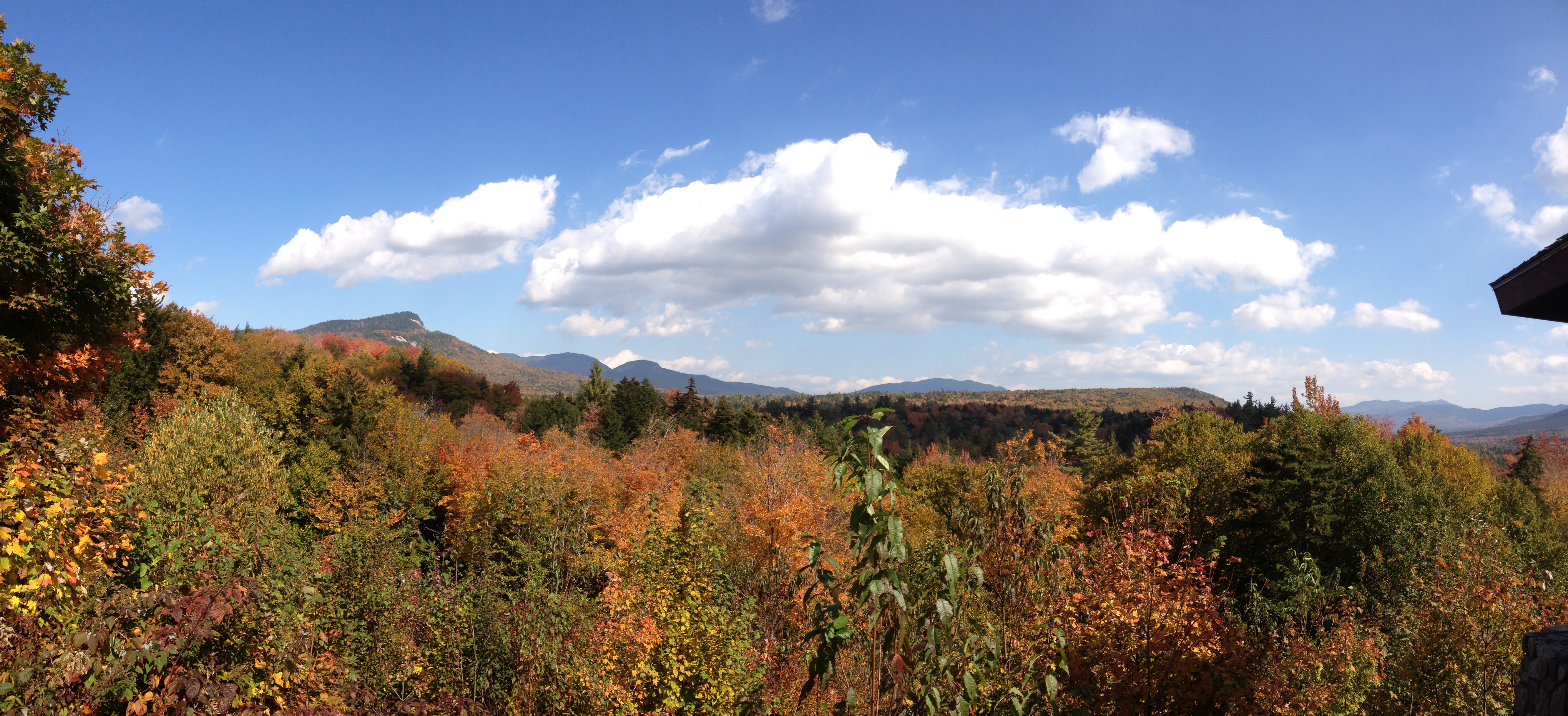
We started out going up Route 89 from Flagstaff. As we motored along, we started to see some incredible vistas. Little did we know that these views were just the beginning of a spectacular day.

Route 89

Route 89 – One of today’s open roads

A little while in to the trip, we saw a sign for Tuba City. We decided to make an impromptu stop there, and we were glad we did. While the vistas from Route 89 were great, Route 160 to Tuba City went through the heart of the Painted Desert. Rich red mesas and rock formations surrounded us. And a few miles down 160, we saw a sign for Dinosaur Tracks. Again, we decided to make a detour. And once again, we weren’t sorry.

We pulled up to some impromptu roadside stands and parked. We were immediately greeted by a young man, Dale, who began talking about the area and the incredible fossils there. We saw our first fossilized footprints in a matter of moments. Dale told us about the history of the area, showed us different areas of interest and different fossils and wowed us with the sights. The ‘guides’ work only for tips, so we gave him some cash and thanked him for his great tour. It turns out that this area could be one of the largest dinosaur track sites in the country. Judging by the hand-painted sign and the humble stands, it’s a pretty well-kept secret. Again, the road less travelled…

First dinosaur tracks

A few feet away from the parking area, you see your first tracks

Tom compares prints

Tom compares prints

Fossilized partial dinosaur skeleton Dinosaur Tracks

Fossilized partial dinosaur skeleton

Tom vs T-Rex

Tom vs baby T-Rex. T-Rex would squish Tom in one step!

Our guide Dale

Our guide Dale

Back on the road, we wound through some incredible country. High mesas, red canyons, massive rock formations, open prairie…we saw it all. Then, we reached the Glen Canyon area and the bridge over the Colorado River. Again, another unplanned stop…and another spectacular view.

Colorado River - Glen Canyon

View from the bridge across the Colorado River in the Glen Canyon area (CLICK TO ENLARGE)

Back on the road, more wonderful views…more jaw-dropping moments like this:

Scenic View

Scenic View (CLICK TO ENLARGE)

We then made it to Utah! Of course, the first town across the border was Kanab. And as you may know, one of my favorite animal sanctuaries is in Kanab. Thus, our next unplanned stop occurred at Best Friends Animal Sanctuary.

Utah State Border

Utah State Border

If you’ve ever watched the National Geographic Channel’s show “Dogtown,” then you’ve seen Best Friends Animal Sanctuary. They rescue, rehabilitate and adopt out animals from cats and dogs to horses, pigs, goats, rabbits and birds that may have been otherwise euthanized. Aside from their notoriety from the TV show, Best Friends is also known as the rescue organization that took in the Michael Vick pit bulls. Unfortunately, we were too late for a tour. But we did get to see the incredible canyon that is home for these animals and we got to chat with the people working at the sanctuary. And of course, Jasmine and Juliet were MORE than welcome in the visitor’s center and gift shop!

Best Friends Animal Sanctuary

Best Friends Animal Sanctuary

We soon said goodbye to Route 89 and hello to Route 9 to Zion.

Welcome to Zion National Park

Welcome to Zion National Park

Getting to our hotel in Springdale meant driving through Zion National Park. And all I could say when I saw the landscape was WOW!

WOW!

WOW!

HOLY COW!

HOLY COW!

And of course, as we were driving with our jaws on our laps, we were brought back down to earth by a local resident. He made us chuckle as he stopped traffic so he could go eat the flowers on the OTHER side of the road.

Munch Munch

Mmmm…those flowers look goooood!

We used Tom’s National Park Senior Pass again (FREE ENTRY FOR LIFE!) and reached our hotel. It’s by far the nicest La Quinta I’ve seen. And what a spectacular view from our balcony:

View from our balcony

View from our balcony

We walked to dinner–we’re close to everything. Tom had to try the Polygamy Porter (Why Have Just One?).

Polygamy Porter

Polygamy Porter – Why have just one?

It has been a long day of driving and “Holy Cow” moments. Tomorrow is promising to be even more inspirational! Of course, all this activity has just exhausted the girls. Juliet is particularly tired due to her digging through the doggie bag in the back seat and ALMOST breaking into the kibble bag. This little girl is going to be trouble…

ZZZZ

ZZZZ–All tuckered out from being bad!

Mark Twain National Forest

Day 10: Thursday, May 9, 2013
Start: Poplar Bluff, MO
End: Cuba, MO
Miles Driven Today: 208
Total Miles: 1,897

Today’s drive took us through the Ozarks and through the Mark Twain National Forest. We have really enjoyed the lonely roads that we have chosen; in most cases, we rarely encountered other cars and were able to drive at a leisurely pace without having to pull over to let a Speedy Gonzales pass by. While thunderstorms were forecast for the area, we were fortunate to skirt the rain and to even enjoy some bright sunshine and warm weather in the afternoon.

Ozarks

Into the Ozarks we go!

We first went through the Ozark National Scenic Riverways area. Two major rivers snake through the Ozarks–the Current River and the Jacks Fork River. The Ozark National Scenic Riverways area was the first National Park area created to protect a wild river system. We went over both rivers while winding our way West on Route 106 and then North on Route 19. There were campgrounds, plenty of places to rent kayaks or inner tubes and lots of open road to enjoy the lush greenry of this area.

Ozark National Scenic Riverways

Fabulous drive through the Ozark National Scenic Riverways

After leaving the Riverways, we meandered Northeast to the Mark Twain National Forest towards the metropolis (NOT) of Bunker. We drove 16 miles up a very bumpy, windy, hilly Route A. But the forest was fabulous and the drive was well worth it. Butler itself was just a few buildings shy of a blip on the map, but we’re focused on journey rather than destination! Thank goodness for that!

Mark Twain National Forest

Entrance to the Mark Twain National Forest

Open road

Oh the open road!

After leaving the Forest, we headed for tonight’s destination: Cuba, Missouri. Cuba is our ‘entry point’ to the next chapter of our journey–driving through the small towns along Historic Route 66! And to start off our Route 66 journey, we booked a room at the Wagon Wheel Motel in downtown Cuba. While I’m unsure why this little motel got so many accolades on TripAdvisor, it certainly has some charm. I just wish the motel owner, Connie, had as much charm as her property. She was as unwelcoming as could be–a very big change from yesterday’s stellar service at the Drury Inn. The room we have is tiny, but it’s clean and quiet. That’s fine with us!

Wagon Wheel Motel Cuba MO

Route 66 Kitsch – Wagon Wheel Motel in Cuba, MO

After settling into our room, we decided to walk through downtown Cuba. Apparently, Cuba is known as the “Mural City” of Route 66. In 2001, the local bank commissioned a mural to commemorate its 100th birthday. A local beautification group soon created a public art project that resulted in a dozen murals created by local and nationally known artists. Bette Davis, Amelia Earhart and Harry Truman are depicted in murals around town, each with a story of their visit to Cuba. I liked the Prosperity Corner mural the best, which wrapped around the building.

Prosperity Corner Mural Cuba MO

The Prosperity Corner Mural in Cuba, MO

Bette Davis Mural Cuba MO

Bette Davis Mural – Cuba, MO

We took Jasmine and Juliet with us on our stroll through Cuba. We got strange stares from the locals since they were in the doggie stroller. In fact, we made such a big splash that the waitress from the Missouri Hick Barbecue recognized us…we had looked at the take-out menu when we began our stroll, and she saw the dogs. She told us her life story, including her quest to find a Dachshund puppy. Finally, there was something even more incredible to look at than the rare Asian: dogs in a stroller!

Speaking of dogs, Jasmine and Juliet are simply exhausted from all this travel. Sleeping in the back seat is really hard work. 🙂

tired puppies

Juliet and Jasmine rest after an exhausting day of sleeping in the back seat

Tomorrow, we start our Route 66 journey in earnest! Can’t wait!